I turn operational bottlenecks into functional technology, from the field to the command centre.
I am Alexandre Chainho, a technical analyst/developer and operational member of the Emergency Technical Support Cell (CSTE) of the Emergency Protection and Rescue Unit (UEPS), in Coimbra. My work brings together operations, analysis and technology development for emergency, prevention and decision-support contexts. I have served in the National Republican Guard (GNR) since 14 November 2005. On 4 May 2006, I joined the Intervention Group for Protection and Rescue (GIPS), which transitioned to UEPS in 2018.
My military career began in September 2001, when I joined the Portuguese Army at the Infantry School in Mafra. Between 2002 and 2003, I took part in the NATO/SFOR international mission in Bosnia and Herzegovina. I completed my Army service on 13 November 2005 and joined the GNR the following day. This experience shaped a way of working based on discipline, responsibility, rigour and the ability to solve problems under pressure — principles I carry into systems designed for operational environments.
My technical training is self-directed and developed from operational necessity. Between 2011 and 2017, I developed the first operational-statistics and incident-georeferencing methods in GIPS/GNR. In 2013, I took part in the pilot project for land inspection in Porto de Mós and Alcanena, aimed at rural-fire prevention. These projects showed me that value does not come only from collecting data: it comes from validating, connecting, presenting and returning information to the people who need to act on it.
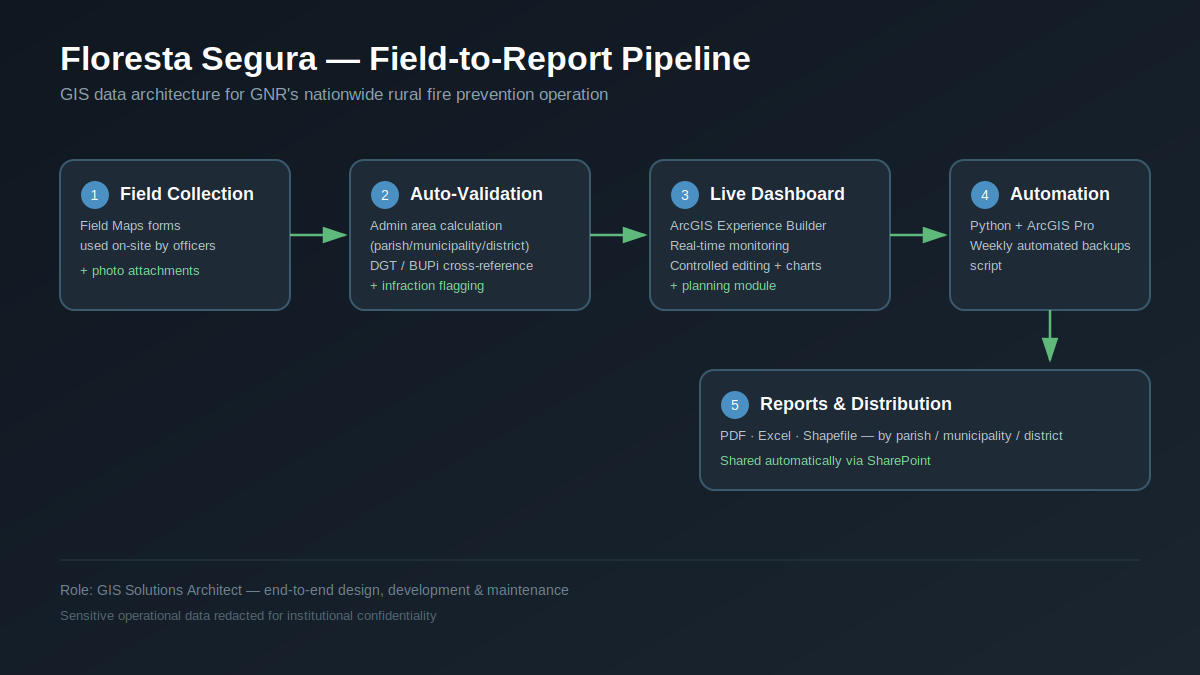
Since 2014, I have designed, developed and maintained the nationwide GIS platforms for Floresta Segura. This work includes georeferenced field collection with Field Maps and QuickCapture, data validation, layer publication and decision-support tools in ArcGIS Online. The platform links field teams, territorial data and coordination needs, turning operational records into current views of activity.
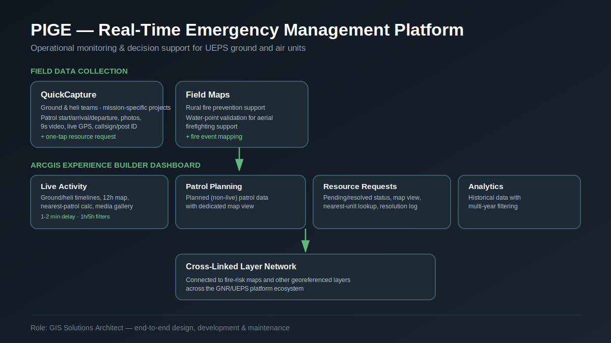
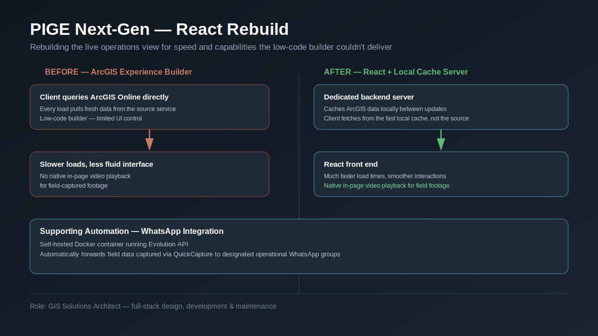
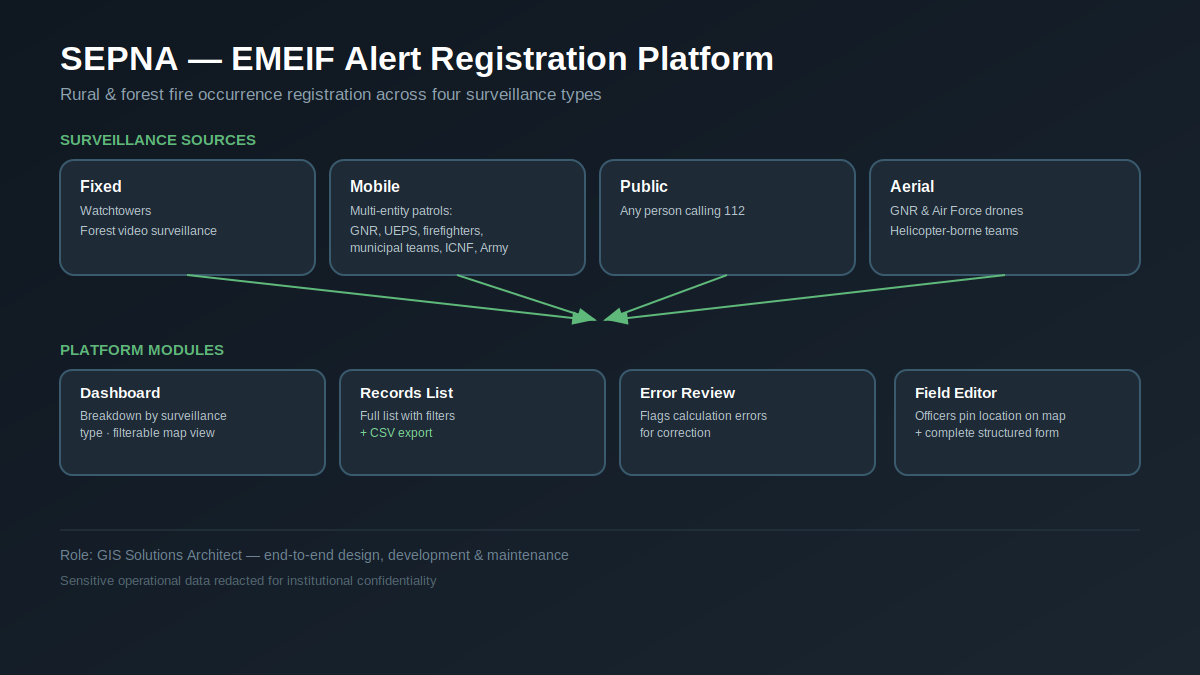
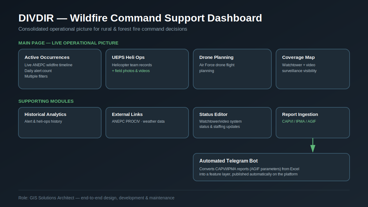
Since 2020, I have developed the UEPS/GNR Integrated Emergency Management Platform (PIGE). It brings together operational collection, dashboards, planning, resource requests, analysis, and automated reports and Python statistics. Its evolution includes a Next-Gen architecture with a React interface and a dedicated local layer for operational use. Since 2022, I have maintained SEPNA/GNR GIS platforms for fire-alert recording and monitoring, including DIVDIR and EMEIF Alerts, which consolidate surveillance sources, incidents and information for command support.
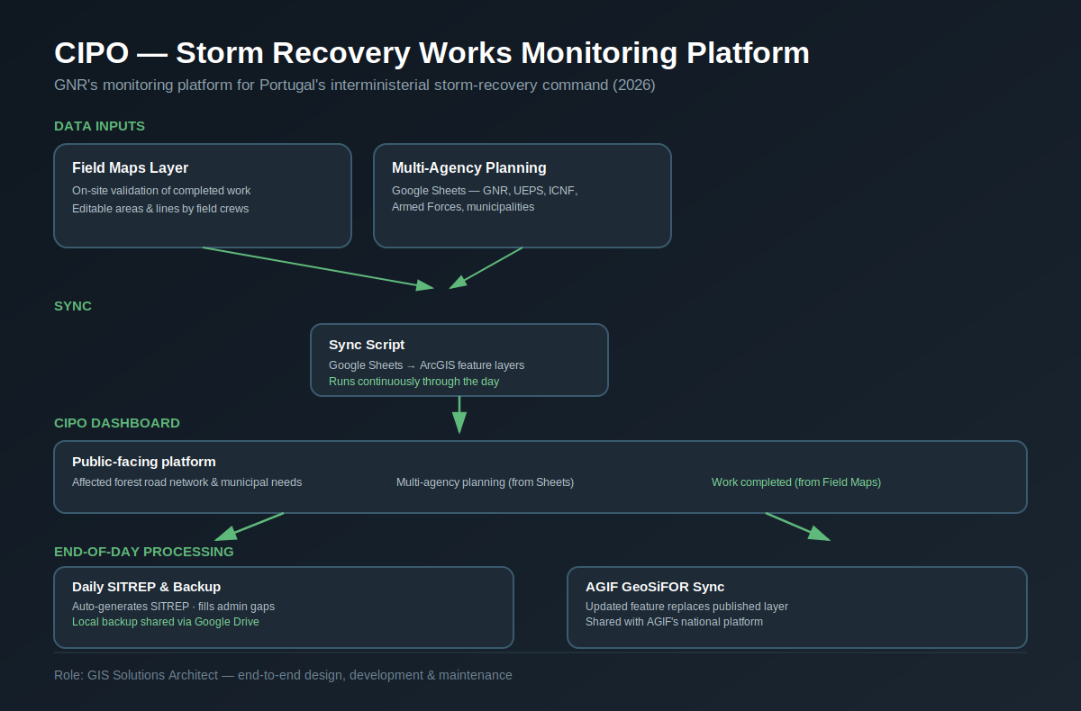
In 2026, within CIPO — Integrated Command for Prevention and Operations — I developed a work-monitoring platform in ArcGIS Online and Field Maps, with an Experience Builder dashboard. The solution supports collection and sharing through AGIF PLIS with intermunicipal communities and municipalities, combining multi-agency data, synchronisation and operational situation reporting.
My work spans ArcGIS Online and ArcGIS Pro, Field Maps, Survey123, QuickCapture, Experience Builder, Python, APIs, web scraping, GeoServer, OpenDroneMap, dashboards, Telegram and WhatsApp bots, dynamic PDF generation and data integration. Since late 2022, I have used AI in a disciplined way to accelerate learning and delivery, moving from Excel-centred workflows to hybrid architectures that combine GIS, Python, databases, web applications and local inference. I also build RAG pipelines and model orchestrators on my own hardware, enabling AI use without sending sensitive information to third-party services.
I usually receive an operational problem, not a technical specification. I analyse the process, identify data and context limitations, propose the architecture, choose sustainable tools, build the solution and present it once it is functional and tested in the real scenario. I work best with scattered data, manual processes, slow reports, alerts that do not arrive in time, or an operational picture that does not yet exist. The objective is not to write code for its own sake: it is to remove the bottleneck, reduce repetitive effort, improve data quality and make actionable information available to people in the field and to decision-makers.